First Alert Weather Day: Arctic air will bring snow to the region
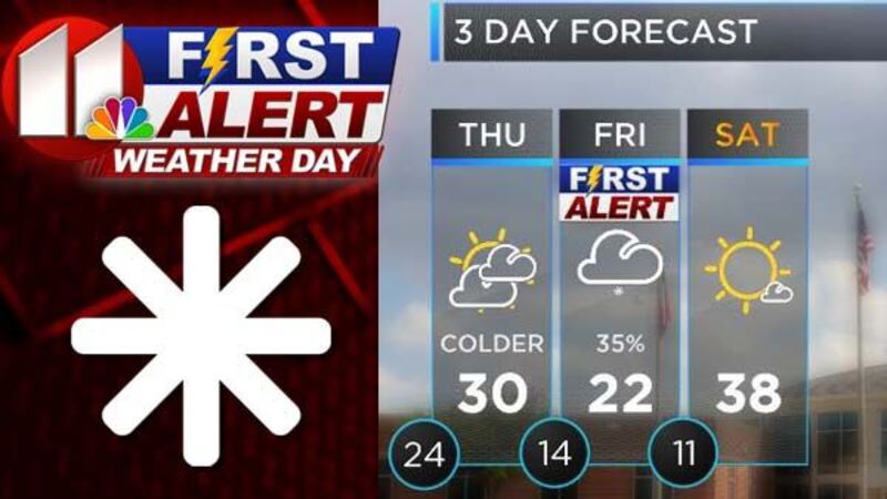
(KCBD) - Don't let the sun and temps in the 40s fool you. By Thursday morning winds will increase from the north at 15-20 mph and colder arctic air will return to the region. That cold air will continue to build in and by Friday morning it will be in the teens and highs will only make it to the low 20s.
Combined with the much colder air is an approaching upper-level disturbance that will bring snow to the region. That's why we've designated Friday as a First Alert Weather Day.
Snow accumulations will vary from near 1" in Lubbock to from 2"-3" in the northern south plains region from Muleshoe east to Tulia and into the panhandle. Travel problems will develop in the northern south plains by early Friday and continue through Saturday morning. Lubbock may also see slick spots Friday morning and during the day and into early Saturday also, but not as bad as the northern regions.
Snowfall amounts could vary depending on the track of the storm system. However, it will be very cold with low wind chills beginning Thursday and lasting into Saturday.
First Alert Weather App
Take the resources of the First Alert Forecast Center with you. The KCBD Weather App is available for iPhone/iTouch, iPad,and Android.
With the KCBD Weather App you get:
Live Radar, Hour-by-Hour forecasts, Multi-day forecasts, Storm tracking, Current Temperatures, Fully integrated GPS, and much more.
Copyright KCBD 2017. All rights reserved.